repos
5 rows where permissions = "{"admin": false, "maintain": false, "push": false, "triage": false, "pull": false}", topics contains "datasette-io" and watchers = 9
This data as json, CSV (advanced)
Suggested facets: owner, homepage, forks_count, forks, network_count, subscribers_count, created_at (date), updated_at (date), pushed_at (date), topics (array)
| id ▼ | node_id | name | full_name | private | owner | html_url | description | fork | created_at | updated_at | pushed_at | homepage | size | stargazers_count | watchers_count | language | has_issues | has_projects | has_downloads | has_wiki | has_pages | forks_count | archived | disabled | open_issues_count | license | topics | forks | open_issues | watchers | default_branch | permissions | temp_clone_token | organization | network_count | subscribers_count | readme | readme_html | allow_forking | visibility | is_template | template_repository | web_commit_signoff_required | has_discussions |
|---|---|---|---|---|---|---|---|---|---|---|---|---|---|---|---|---|---|---|---|---|---|---|---|---|---|---|---|---|---|---|---|---|---|---|---|---|---|---|---|---|---|---|---|---|
| 135007287 | MDEwOlJlcG9zaXRvcnkxMzUwMDcyODc= | datasette-leaflet-geojson | simonw/datasette-leaflet-geojson | 0 | simonw 9599 | https://github.com/simonw/datasette-leaflet-geojson | Datasette plugin that replaces any GeoJSON column values with a Leaflet map. | 0 | 2018-05-27T01:42:30Z | 2022-08-26T23:27:11Z | 2022-08-26T23:27:08Z | 91 | 9 | 9 | Python | 1 | 1 | 1 | 1 | 0 | 4 | 0 | 0 | 3 | ["datasette", "datasette-io", "datasette-plugin", "gis", "leaflet"] | 4 | 3 | 9 | main | {"admin": false, "maintain": false, "push": false, "triage": false, "pull": false} | 4 | 2 | # datasette-leaflet-geojson [](https://pypi.org/project/datasette-leaflet-geojson/) [](https://github.com/simonw/datasette-leaflet-geojson/releases) [](https://github.com/simonw/datasette-leaflet-geojson/actions?query=workflow%3ATest) [](https://github.com/simonw/datasette-leaflet-geojson/blob/main/LICENSE) Datasette plugin that replaces any GeoJSON column values with a Leaflet map ## Installation Install this plugin in the same environment as Datasette. $ datasette install datasette-leaflet-geojson ## Usage Any columns containing valid GeoJSON strings will have their contents replaced with a Leaflet map when they are displayed in the Datasette interface. ## Demo You can try this plugin out at https://calands.datasettes.com/calands/superunits_with_maps 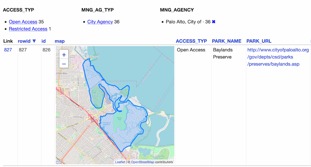 ## Configuration By default this plugin displays maps for the first ten rows, and shows a "Click to load map" prompt for rows past the first ten. You can change this limit using the `default_maps_to_load` plugin configuration setting. Add this to your `metadata.json`: ```json { "plugins": { "datasette-leaflet-geojson": { "default_maps_to_load": 20 } } } ``` Then run Datasette with `datasette mydb.db -m metadata.json`. | <div id="readme" class="md" data-path="README.md"><article class="markdown-body entry-content container-lg" itemprop="text"><h1 dir="auto"><a id="user-content-datasette-leaflet-geojson" class="anchor" aria-hidden="true" href="#user-content-datasette-leaflet-geojson"><svg class="octicon octicon-link" viewBox="0 0 16 16" version="1.1" width="16" height="16" aria-hidden="true"><path fill-rule="evenodd" d="M7.775 3.275a.75.75 0 001.06 1.06l1.25-1.25a2 2 0 112.83 2.83l-2.5 2.5a2 2 0 01-2.83 0 .75.75 0 00-1.06 1.06 3.5 3.5 0 004.95 0l2.5-2.5a3.5 3.5 0 00-4.95-4.95l-1.25 1.25zm-4.69 9.64a2 2 0 010-2.83l2.5-2.5a2 2 0 012.83 0 .75.75 0 001.06-1.06 3.5 3.5 0 00-4.95 0l-2.5 2.5a3.5 3.5 0 004.95 4.95l1.25-1.25a.75.75 0 00-1.06-1.06l-1.25 1.25a2 2 0 01-2.83 0z"></path></svg></a>datasette-leaflet-geojson</h1> <p dir="auto"><a href="https://pypi.org/project/datasette-leaflet-geojson/" rel="nofollow"><img src="https://camo.githubusercontent.com/c4cff7db933b6c868aae197528f088312b804050a0aad5ba2beaa8c2cbf23d72/68747470733a2f2f696d672e736869656c64732e696f2f707970692f762f6461746173657474652d6c6561666c65742d67656f6a736f6e2e737667" alt="PyPI" data-canonical-src="https://img.shields.io/pypi/v/datasette-leaflet-geojson.svg" style="max-width: 100%;"></a> <a href="https://github.com/simonw/datasette-leaflet-geojson/releases"><img src="https://camo.githubusercontent.com/2ac8aa347c051365984375e84c15b4887c4a377dbc495db5320ebfbc409bbb2b/68747470733a2f2f696d672e736869656c64732e696f2f6769746875622f762f72656c656173652f73696d6f6e772f6461746173657474652d6c6561666c65742d67656f6a736f6e3f696e636c7564655f70726572656c6561736573266c6162656c3d6368616e67656c6f67" alt="Changelog" data-canonical-src="https://img.shields.io/github/v/release/simonw/datasette-leaflet-geojson?include_prereleases&label=changelog" style="max-width: 100%;"></a> <a href="https://github.com/simonw/datasette-leaflet-geojson/actions?query=workflow%3ATest"><img src="https://github.com/simonw/datasette-leaflet-geojson/workflows/Test/badge.svg" alt="Tests" style="max-width: 100%;"></… | 1 | public | 0 | 0 | ||||||
| 234825790 | MDEwOlJlcG9zaXRvcnkyMzQ4MjU3OTA= | datasette-upload-csvs | simonw/datasette-upload-csvs | 0 | simonw 9599 | https://github.com/simonw/datasette-upload-csvs | Datasette plugin for uploading CSV files and converting them to database tables | 0 | 2020-01-19T02:07:05Z | 2022-07-03T20:58:20Z | 2022-09-09T16:23:59Z | https://datasette.io/plugins/datasette-upload-csvs | 58 | 9 | 9 | Python | 1 | 1 | 1 | 1 | 0 | 1 | 0 | 0 | 4 | Apache License 2.0 apache-2.0 | ["csvs", "datasette", "datasette-io", "datasette-plugin"] | 1 | 4 | 9 | main | {"admin": false, "maintain": false, "push": false, "triage": false, "pull": false} | 1 | 2 | # datasette-upload-csvs [](https://pypi.org/project/datasette-upload-csvs/) [](https://github.com/simonw/datasette-upload-csvs/releases) [](https://github.com/simonw/datasette-upload-csvs/actions?query=workflow%3ATest) [](https://github.com/simonw/datasette-upload-csvs/blob/main/LICENSE) Datasette plugin for uploading CSV files and converting them to database tables ## Installation datasette install datasette-upload-csvs ## Usage The plugin adds an interface at `/-/upload-csvs` for uploading a CSV file and using it to create a new database table. By default only [the root actor](https://datasette.readthedocs.io/en/stable/authentication.html#using-the-root-actor) can access the page - so you'll need to run Datasette with the `--root` option and click on the link shown in the terminal to sign in and access the page. The `upload-csvs` permission governs access. You can use permission plugins such as [datasette-permissions-sql](https://github.com/simonw/datasette-permissions-sql) to grant additional access to the write interface. | <div id="readme" class="md" data-path="README.md"><article class="markdown-body entry-content container-lg" itemprop="text"><h1 dir="auto"><a id="user-content-datasette-upload-csvs" class="anchor" aria-hidden="true" href="#user-content-datasette-upload-csvs"><svg class="octicon octicon-link" viewBox="0 0 16 16" version="1.1" width="16" height="16" aria-hidden="true"><path fill-rule="evenodd" d="M7.775 3.275a.75.75 0 001.06 1.06l1.25-1.25a2 2 0 112.83 2.83l-2.5 2.5a2 2 0 01-2.83 0 .75.75 0 00-1.06 1.06 3.5 3.5 0 004.95 0l2.5-2.5a3.5 3.5 0 00-4.95-4.95l-1.25 1.25zm-4.69 9.64a2 2 0 010-2.83l2.5-2.5a2 2 0 012.83 0 .75.75 0 001.06-1.06 3.5 3.5 0 00-4.95 0l-2.5 2.5a3.5 3.5 0 004.95 4.95l1.25-1.25a.75.75 0 00-1.06-1.06l-1.25 1.25a2 2 0 01-2.83 0z"></path></svg></a>datasette-upload-csvs</h1> <p dir="auto"><a href="https://pypi.org/project/datasette-upload-csvs/" rel="nofollow"><img src="https://camo.githubusercontent.com/0579577329c092ea76dd2672cfa6077ecd82c918c9d3caa9c8ff26be02104f78/68747470733a2f2f696d672e736869656c64732e696f2f707970692f762f6461746173657474652d75706c6f61642d637376732e737667" alt="PyPI" data-canonical-src="https://img.shields.io/pypi/v/datasette-upload-csvs.svg" style="max-width: 100%;"></a> <a href="https://github.com/simonw/datasette-upload-csvs/releases"><img src="https://camo.githubusercontent.com/34f7f9b455f75c80e8b706ff050dc59f70a926b93af51457f14f0a1d290f47bc/68747470733a2f2f696d672e736869656c64732e696f2f6769746875622f762f72656c656173652f73696d6f6e772f6461746173657474652d75706c6f61642d637376733f696e636c7564655f70726572656c6561736573266c6162656c3d6368616e67656c6f67" alt="Changelog" data-canonical-src="https://img.shields.io/github/v/release/simonw/datasette-upload-csvs?include_prereleases&label=changelog" style="max-width: 100%;"></a> <a href="https://github.com/simonw/datasette-upload-csvs/actions?query=workflow%3ATest"><img src="https://github.com/simonw/datasette-upload-csvs/workflows/Test/badge.svg" alt="Tests" style="max-width: 100%;"></a> <a href="https://github.com/simonw/datasette-uplo… | 1 | public | 0 | 0 | ||||
| 280500027 | MDEwOlJlcG9zaXRvcnkyODA1MDAwMjc= | datasette-insert | simonw/datasette-insert | 0 | simonw 9599 | https://github.com/simonw/datasette-insert | Datasette plugin for inserting and updating data | 0 | 2020-07-17T18:40:34Z | 2022-06-27T02:54:14Z | 2022-07-22T17:52:23Z | 54 | 9 | 9 | Python | 1 | 1 | 1 | 1 | 0 | 0 | 0 | 0 | 1 | ["datasette", "datasette-io", "datasette-plugin"] | 0 | 1 | 9 | main | {"admin": false, "maintain": false, "push": false, "triage": false, "pull": false} | 0 | 2 | # datasette-insert [](https://pypi.org/project/datasette-insert/) [](https://github.com/simonw/datasette-insert/releases) [](https://github.com/simonw/datasette-insert/blob/master/LICENSE) Datasette plugin for inserting and updating data ## Installation Install this plugin in the same environment as Datasette. $ pip install datasette-insert This plugin should always be deployed with additional configuration to prevent unauthenticated access, see notes below. If you are trying it out on your own local machine, you can `pip install` the [datasette-insert-unsafe](https://github.com/simonw/datasette-insert-unsafe) plugin to allow access without needing to set up authentication or permissions separately. ## Inserting data and creating tables Start datasette and make sure it has a writable SQLite database attached to it. If you have not yet created a database file you can use this: datasette data.db --create The `--create` option will create a new empty `data.db` database file if it does not already exist. The plugin adds an endpoint that allows data to be inserted or updated and tables to be created by POSTing JSON data to the following URL: /-/insert/name-of-database/name-of-table The JSON should look like this: ```json [ { "id": 1, "name": "Cleopaws", "age": 5 }, { "id": 2, "name": "Pancakes", "age": 5 } ] ``` The first time data is posted to the URL a table of that name will be created if it does not aready exist, with the desired columns. You can specify which column should be used as the primary key using the `?pk=` URL argument. Here's how to POST to a database and create a new table using the Python `requests` library: ```python import requests requests.post("http://localhost:800… | <div id="readme" class="md" data-path="README.md"><article class="markdown-body entry-content container-lg" itemprop="text"><h1 dir="auto"><a id="user-content-datasette-insert" class="anchor" aria-hidden="true" href="#user-content-datasette-insert"><svg class="octicon octicon-link" viewBox="0 0 16 16" version="1.1" width="16" height="16" aria-hidden="true"><path fill-rule="evenodd" d="M7.775 3.275a.75.75 0 001.06 1.06l1.25-1.25a2 2 0 112.83 2.83l-2.5 2.5a2 2 0 01-2.83 0 .75.75 0 00-1.06 1.06 3.5 3.5 0 004.95 0l2.5-2.5a3.5 3.5 0 00-4.95-4.95l-1.25 1.25zm-4.69 9.64a2 2 0 010-2.83l2.5-2.5a2 2 0 012.83 0 .75.75 0 001.06-1.06 3.5 3.5 0 00-4.95 0l-2.5 2.5a3.5 3.5 0 004.95 4.95l1.25-1.25a.75.75 0 00-1.06-1.06l-1.25 1.25a2 2 0 01-2.83 0z"></path></svg></a>datasette-insert</h1> <p dir="auto"><a href="https://pypi.org/project/datasette-insert/" rel="nofollow"><img src="https://camo.githubusercontent.com/f8375e92990e2f5fdcf4657451dccba02132abfd34e39bb49773201264951b85/68747470733a2f2f696d672e736869656c64732e696f2f707970692f762f6461746173657474652d696e736572742e737667" alt="PyPI" data-canonical-src="https://img.shields.io/pypi/v/datasette-insert.svg" style="max-width: 100%;"></a> <a href="https://github.com/simonw/datasette-insert/releases"><img src="https://camo.githubusercontent.com/035155855612d32c93ac562f5316c97a15edc01cc0ef35ad4535951368e9ff42/68747470733a2f2f696d672e736869656c64732e696f2f6769746875622f762f72656c656173652f73696d6f6e772f6461746173657474652d696e736572743f696e636c7564655f70726572656c6561736573266c6162656c3d6368616e67656c6f67" alt="Changelog" data-canonical-src="https://img.shields.io/github/v/release/simonw/datasette-insert?include_prereleases&label=changelog" style="max-width: 100%;"></a> <a href="https://github.com/simonw/datasette-insert/blob/master/LICENSE"><img src="https://camo.githubusercontent.com/1698104e976c681143eb0841f9675c6f802bb7aa832afc0c7a4e719b1f3cf955/68747470733a2f2f696d672e736869656c64732e696f2f62616467652f6c6963656e73652d417061636865253230322e302d626c75652e737667" alt="License" dat… | 1 | public | 0 | 0 | ||||||
| 331151708 | MDEwOlJlcG9zaXRvcnkzMzExNTE3MDg= | datasette-leaflet-freedraw | simonw/datasette-leaflet-freedraw | 0 | simonw 9599 | https://github.com/simonw/datasette-leaflet-freedraw | Draw polygons on maps in Datasette | 0 | 2021-01-20T00:55:03Z | 2021-12-17T22:07:50Z | 2022-02-03T20:24:37Z | 1177 | 9 | 9 | Python | 1 | 1 | 1 | 1 | 0 | 2 | 0 | 0 | 2 | ["datasette", "datasette-io", "datasette-plugin", "leafletjs"] | 2 | 2 | 9 | main | {"admin": false, "maintain": false, "push": false, "triage": false, "pull": false} | 2 | 2 | # datasette-leaflet-freedraw [](https://pypi.org/project/datasette-leaflet-freedraw/) [](https://github.com/simonw/datasette-leaflet-freedraw/releases) [](https://github.com/simonw/datasette-leaflet-freedraw/actions?query=workflow%3ATest) [](https://github.com/simonw/datasette-leaflet-freedraw/blob/main/LICENSE) Draw polygons on maps in Datasette Project background: [Drawing shapes on a map to query a SpatiaLite database](https://simonwillison.net/2021/Jan/24/drawing-shapes-spatialite/). ## Installation Install this plugin in the same environment as Datasette. $ datasette install datasette-leaflet-freedraw ## Usage If a table has a SpatiaLite `geometry` column, the plugin will add a map interface to the table page allowing users to draw a shape on the map to find rows with a geometry that intersects that shape. The plugin can also work with arbitrary SQL queries. There it looks for input fields with a name of `freedraw` or that ends in `_freedraw` and replaces them with a map interface. The map interface uses the [FreeDraw](https://freedraw.herokuapp.com/) Leaflet plugin. ## Demo You can try out this plugin to run searches against the GreenInfo Network California Protected Areas Database. Here's [an example query](https://calands.datasettes.com/calands?sql=select%0D%0A++AsGeoJSON%28geometry%29%2C+*%0D%0Afrom%0D%0A++CPAD_2020a_SuperUnits%0D%0Awhere%0D%0A++PARK_NAME+like+%27%25mini%25%27+and%0D%0A++Intersects%28GeomFromGeoJSON%28%3Afreedraw%29%2C+geometry%29+%3D+1%0D%0A++and+CPAD_2020a_SuperUnits.rowid+in+%28%0D%0A++++select%0D%0A++++++rowid%0D%0A++++from%0D%0A++++++SpatialIndex%0D%0A++++where%0D%0A++++++f_table_name+%3D+%27CPAD_2020a_SuperUnits%27%0D%0A+++… | <div id="readme" class="md" data-path="README.md"><article class="markdown-body entry-content container-lg" itemprop="text"><h1 dir="auto"><a id="user-content-datasette-leaflet-freedraw" class="anchor" aria-hidden="true" href="#user-content-datasette-leaflet-freedraw"><svg class="octicon octicon-link" viewBox="0 0 16 16" version="1.1" width="16" height="16" aria-hidden="true"><path fill-rule="evenodd" d="M7.775 3.275a.75.75 0 001.06 1.06l1.25-1.25a2 2 0 112.83 2.83l-2.5 2.5a2 2 0 01-2.83 0 .75.75 0 00-1.06 1.06 3.5 3.5 0 004.95 0l2.5-2.5a3.5 3.5 0 00-4.95-4.95l-1.25 1.25zm-4.69 9.64a2 2 0 010-2.83l2.5-2.5a2 2 0 012.83 0 .75.75 0 001.06-1.06 3.5 3.5 0 00-4.95 0l-2.5 2.5a3.5 3.5 0 004.95 4.95l1.25-1.25a.75.75 0 00-1.06-1.06l-1.25 1.25a2 2 0 01-2.83 0z"></path></svg></a>datasette-leaflet-freedraw</h1> <p dir="auto"><a href="https://pypi.org/project/datasette-leaflet-freedraw/" rel="nofollow"><img src="https://camo.githubusercontent.com/43771dd02f1327b1f2ae2bdd743e01865626d143ca9e98a37700a8747300465f/68747470733a2f2f696d672e736869656c64732e696f2f707970692f762f6461746173657474652d6c6561666c65742d66726565647261772e737667" alt="PyPI" data-canonical-src="https://img.shields.io/pypi/v/datasette-leaflet-freedraw.svg" style="max-width: 100%;"></a> <a href="https://github.com/simonw/datasette-leaflet-freedraw/releases"><img src="https://camo.githubusercontent.com/8c5d6738c95e5fb3628c688c1eb79e970c822e9880493b52f0a62089e1b3e40c/68747470733a2f2f696d672e736869656c64732e696f2f6769746875622f762f72656c656173652f73696d6f6e772f6461746173657474652d6c6561666c65742d66726565647261773f696e636c7564655f70726572656c6561736573266c6162656c3d6368616e67656c6f67" alt="Changelog" data-canonical-src="https://img.shields.io/github/v/release/simonw/datasette-leaflet-freedraw?include_prereleases&label=changelog" style="max-width: 100%;"></a> <a href="https://github.com/simonw/datasette-leaflet-freedraw/actions?query=workflow%3ATest"><img src="https://github.com/simonw/datasette-leaflet-freedraw/workflows/Test/badge.svg" alt="Tests" style="max-wid… | 1 | public | 0 | |||||||
| 382986564 | MDEwOlJlcG9zaXRvcnkzODI5ODY1NjQ= | datasette-geojson-map | eyeseast/datasette-geojson-map | 0 | eyeseast 25778 | https://github.com/eyeseast/datasette-geojson-map | Render a map for any query with a geometry column | 0 | 2021-07-05T01:54:13Z | 2022-03-04T00:16:17Z | 2022-04-27T20:39:47Z | 3651 | 9 | 9 | Python | 1 | 1 | 1 | 1 | 0 | 0 | 0 | 0 | 10 | ["datasette-io", "datasette-plugin", "geojson", "gis", "leafletjs", "mapping"] | 0 | 10 | 9 | main | {"admin": false, "maintain": false, "push": false, "triage": false, "pull": false} | 0 | 1 | # datasette-geojson-map [](https://pypi.org/project/datasette-geojson-map/) [](https://github.com/eyeseast/datasette-geojson-map/releases) [](https://github.com/eyeseast/datasette-geojson-map/actions?query=workflow%3ATest) [](https://github.com/eyeseast/datasette-geojson-map/blob/main/LICENSE) Render a map for any query with a geometry column ## Installation Install this plugin in the same environment as Datasette. $ datasette install datasette-geojson-map ## Usage Start by loading a GIS file. For example, you might use [geojson-to-sqlite](https://pypi.org/project/geojson-to-sqlite/) or [shapefile-to-sqlite](https://pypi.org/project/shapefile-to-sqlite/) to load [neighborhood boundaries](https://bostonopendata-boston.opendata.arcgis.com/datasets/3525b0ee6e6b427f9aab5d0a1d0a1a28_0/explore) into a SQLite database. ```sh wget -O neighborhoods.geojson https://opendata.arcgis.com/datasets/3525b0ee6e6b427f9aab5d0a1d0a1a28_0.geojson geojson-to-sqlite boston.db neighborhoods neighborhoods.geojson ``` (The command above uses Spatialite, but that's not required.) Start up `datasette` and navigate to the `neighborhoods` table. ```sh datasette serve boston.db # in another terminal tab open http://localhost:8001/boston/neighborhoods ``` You should see a map centered on Boston with each neighborhood outlined. Clicking a boundary will bring up a popup with details on that feature.  This plugin relies on (and will install) [datasette-geojson](https://github.com/eyeseast/datasette-geojson). Any query that includes a `geometry` column will produce a map of the results. This also includes single row views. Run the incl… | <div id="readme" class="md" data-path="README.md"><article class="markdown-body entry-content container-lg" itemprop="text"><h1 dir="auto"><a id="user-content-datasette-geojson-map" class="anchor" aria-hidden="true" href="#user-content-datasette-geojson-map"><svg class="octicon octicon-link" viewBox="0 0 16 16" version="1.1" width="16" height="16" aria-hidden="true"><path fill-rule="evenodd" d="M7.775 3.275a.75.75 0 001.06 1.06l1.25-1.25a2 2 0 112.83 2.83l-2.5 2.5a2 2 0 01-2.83 0 .75.75 0 00-1.06 1.06 3.5 3.5 0 004.95 0l2.5-2.5a3.5 3.5 0 00-4.95-4.95l-1.25 1.25zm-4.69 9.64a2 2 0 010-2.83l2.5-2.5a2 2 0 012.83 0 .75.75 0 001.06-1.06 3.5 3.5 0 00-4.95 0l-2.5 2.5a3.5 3.5 0 004.95 4.95l1.25-1.25a.75.75 0 00-1.06-1.06l-1.25 1.25a2 2 0 01-2.83 0z"></path></svg></a>datasette-geojson-map</h1> <p dir="auto"><a href="https://pypi.org/project/datasette-geojson-map/" rel="nofollow"><img src="https://camo.githubusercontent.com/1534879e09b364c34ab31432e489c7be09c28cdc94c68a85f1ffefc9b2a0f8df/68747470733a2f2f696d672e736869656c64732e696f2f707970692f762f6461746173657474652d67656f6a736f6e2d6d61702e737667" alt="PyPI" data-canonical-src="https://img.shields.io/pypi/v/datasette-geojson-map.svg" style="max-width: 100%;"></a> <a href="https://github.com/eyeseast/datasette-geojson-map/releases"><img src="https://camo.githubusercontent.com/d45ff62474954cad3f625bc2d1e121eec6e3b2797d55917af6419fb819b45cef/68747470733a2f2f696d672e736869656c64732e696f2f6769746875622f762f72656c656173652f65796573656173742f6461746173657474652d67656f6a736f6e2d6d61703f696e636c7564655f70726572656c6561736573266c6162656c3d6368616e67656c6f67" alt="Changelog" data-canonical-src="https://img.shields.io/github/v/release/eyeseast/datasette-geojson-map?include_prereleases&label=changelog" style="max-width: 100%;"></a> <a href="https://github.com/eyeseast/datasette-geojson-map/actions?query=workflow%3ATest"><img src="https://github.com/eyeseast/datasette-geojson-map/workflows/Test/badge.svg" alt="Tests" style="max-width: 100%;"></a> <a href="https://github.com/eyeseast/… | 1 | public | 0 |
Advanced export
JSON shape: default, array, newline-delimited, object
CREATE TABLE [repos] (
   [id] INTEGER PRIMARY KEY,
   [node_id] TEXT,
   [name] TEXT,
   [full_name] TEXT,
   [private] INTEGER,
   [owner] INTEGER REFERENCES [users]([id]),
   [html_url] TEXT,
   [description] TEXT,
   [fork] INTEGER,
   [created_at] TEXT,
   [updated_at] TEXT,
   [pushed_at] TEXT,
   [homepage] TEXT,
   [size] INTEGER,
   [stargazers_count] INTEGER,
   [watchers_count] INTEGER,
   [language] TEXT,
   [has_issues] INTEGER,
   [has_projects] INTEGER,
   [has_downloads] INTEGER,
   [has_wiki] INTEGER,
   [has_pages] INTEGER,
   [forks_count] INTEGER,
   [archived] INTEGER,
   [disabled] INTEGER,
   [open_issues_count] INTEGER,
   [license] TEXT,
   [topics] TEXT,
   [forks] INTEGER,
   [open_issues] INTEGER,
   [watchers] INTEGER,
   [default_branch] TEXT,
   [permissions] TEXT,
   [temp_clone_token] TEXT,
   [organization] INTEGER REFERENCES [users]([id]),
   [network_count] INTEGER,
   [subscribers_count] INTEGER, [readme] TEXT, [readme_html] TEXT, [allow_forking] INTEGER, [visibility] TEXT, [is_template] INTEGER, [template_repository] TEXT, [web_commit_signoff_required] INTEGER, [has_discussions] INTEGER,
   FOREIGN KEY([license]) REFERENCES [licenses]([key])
);
CREATE INDEX [idx_repos_license]
    ON [repos] ([license]);
CREATE INDEX [idx_repos_organization]
    ON [repos] ([organization]);
CREATE INDEX [idx_repos_owner]
    ON [repos] ([owner]);